


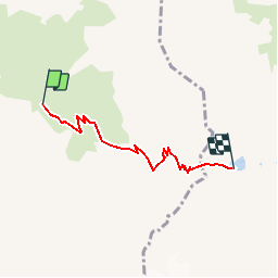
Col et lac de la Croix

raymondfn
User

Length
4.1 km

Max alt
2534 m

Uphill gradient
733 m
Km-Effort
11.8 km

Min alt
1789 m

Downhill gradient
107 m
Boucle
No
Creation date :
2019-08-01 17:13:09.107
Updated on :
2019-08-01 17:13:38.143
2h35
Difficulty : Medium

FREE GPS app for hiking
 SityTrail
IGN / Geographical institutes
SityTrail Plus
The world is yours!
About
Trail Walking of 4.1 km to be discovered at Auvergne-Rhône-Alpes, Isère, Le Haut-Bréda. This trail is proposed by raymondfn.
Positioning
Country:
France
Region :
Auvergne-Rhône-Alpes
Department/Province :
Isère
Municipality :
Le Haut-Bréda
Location:
La Ferrière
Start:(Dec)
Start:(UTM)
273603 ; 5016419 (32T) N.
Comments